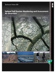
Файл:Upland soil erosion monitoring and assessment - an overview (IA uplandsoilerosio00ypsi).pdf
Содержимое страницы недоступно на других языках.
Материал из Wikivoyage

Размер этого JPG-превью для исходного PDF-файла: 463 × 599 пкс. Другие разрешения: 185 × 240 пкс | 371 × 480 пкс | 593 × 768 пкс | 1275 × 1650 пкс.
Исходный файл (1275 × 1650 пкс. Размер файла: 1,12 МБ, MIME-тип: application/pdf. 48 страниц)
Этот файл из на Викискладе и может использоваться в других проектах. Информация с его страницы описания приведена ниже.
Краткое описание
| Upland soil erosion monitoring and assessment : an overview
( |
||
|---|---|---|
| Автор |
Ypsilantis, Bill |
|
| Название |
Upland soil erosion monitoring and assessment : an overview |
|
| Издательство |
|
|
| Описание |
Subjects: United States. Bureau of Land Management; United States. Bureau of Land Management; Soil ecology; Upland ecology; Soil erosion -- Monitoring -- Methodology; Soil erosion -- Data processing -- Analysis; Public lands -- United States -- Management; Public lands -- Management; Soil ecology; Soil erosion; Soil erosion -- Data processing; Upland ecology; United States |
|
| Язык | английский | |
| Дата публикации | 2011 | |
| Текущее местонахождение |
IA Collections: blmlibrary; fedlink; americana |
|
| Инвентарный номер |
uplandsoilerosio00ypsi |
|
| Авторитетный файл | OCLC: 948676022 | |
| Источник | ||
Лицензирование
| Public domainPublic domainfalsefalse |
Это произведение находится в общественном достоянии (англ. public domain) в Соединённых Штатах Америки, так как оно является работой, выполненной должностным лицом или наёмным сотрудником Федерального правительства США в качестве части служебных обязанностей этого лица. Правовой статус регламентируется в соответствии с разделом 17, главой 1, секцией 105 Кодекса Соединённых Штатов. См. Авторское право.
Обратите внимание: это относится только к оригинальным (первоначальным) произведениям Федерального правительства, а не к произведениям любого отдельного штата США, территории, содружества, округа, муниципалитета или любой другой территориальной единицы. Этот шаблон также не относится к дизайну почтовых марок, изданных Почтовой службой США с 1978 года. (См. § 313.6(C)(1) в Compendium of U.S. Copyright Office Practices). Это также не относится к определённым монетам США; см. Условия использования Монетного двора США.
|
 | |
| Этот файл был определён как свободный от известных ограничений авторского права, а также связанных и смежных прав. | ||
https://creativecommons.org/publicdomain/mark/1.0/PDMCreative Commons Public Domain Mark 1.0falsefalse
Краткие подписи
Добавьте однострочное описание того, что собой представляет этот файл
Элементы, изображённые на этом файле
изображённый объект
application/pdf
История файла
Нажмите на дату/время, чтобы увидеть версию файла от того времени.
| Дата/время | Миниатюра | Размеры | Участник | Примечание | |
|---|---|---|---|---|---|
| текущий | 21:08, 25 июля 2020 |  | 1275 × 1650, 48 страниц (1,12 МБ) | Fæ | FEDLINK - United States Federal Collection uplandsoilerosio00ypsi (User talk:Fæ/IA books#Fork8) (batch 1993-2020 #31433) |
Использование файла
Нет страниц, использующих этот файл.
Метаданные
Файл содержит дополнительные данные, обычно добавляемые цифровыми камерами или сканерами. Если файл после создания редактировался, то некоторые параметры могут не соответствовать текущему изображению.
| Программное обеспечение | Adobe InDesign CS4 (6.0.6) |
|---|---|
| Программа преобразования | Adobe PDF Library 9.0 |
| Шифрование | no |
| Размер страницы |
|
| Версия в формате PDF | 1.6 |


